Adventure America Destinations USA

Discover Moab, Utah: A journey through time

Discover Moab Utah

Greetings, fellow explorers! Join me on a virtual adventure as I take you on a captivating journey through the mesmerizing landscapes of Moab, Utah. Buckle up and get ready to witness the breathtaking beauty of this enchanting region that has stolen my heart since my very first visit in 1999.

In April 2023, I embarked on an unforgettable expedition to Moab, and I am delighted to share with you the hidden gems, stunning vistas, and awe-inspiring backroads that I discovered during my exploration. This desert paradise, nestled in the heart of Utah, offers a plethora of captivating destinations that will leave you spellbound.

Discover Moab Utah

Discover Moab Utah
Gemini Bridges Rd. The entire length of the trail is incredibly scenic offering beautiful views of the Moab Valley and the La Sal Mountains, interesting rock features, and two rock bridge crossings that you hike to. It’s best to see the bridges in the early morning hours.
Discover Moab Utah
The Shafer Trail at the Island in the Sky district of Canyonlands National Park is an iconic road that descends 1,500 feet (457 m) through a colorful, massive sandstone cliff. Its function has changed through the years; from a route made by Native Americans to access resources on the mesa top, to a trail for sheep herders moving flocks to better foraging in winter time, and then a road for trucks moving loads of uranium from the backcountry to market. Today, the Shafer Trail is a challenging, unpaved backcountry road for recreational users seeking the experience of a lifetime.
Discover Moab Utah
Thelma & Louise. The Thunderbird flying through the air was the final scene to shoot before production wrapped. The crew loaded up their gear and headed out on Shafer Trail towards the spot now affectionately known as, Thelma & Louise Point. Unfortunately, we had no idea where, from the Point, the Thunderbird took off.

Discover Moab Utah

Discover Moab Utah

Discover Moab Utah
La Sal Mountains. The main access is via the La Sal Mountain Loop Road, a 37-mile route, all paved though narrow, steep, and winding in some places, which starts in the north at Castle Valley, south of the Colorado River, climbing steadily to a height of 8,050 feet, curving across the northern and western slopes then descending to an alternative start point in Spanish Valley, south of Moab. Views are excellent, of the two national parks and the city, and of many more distant features. This is an easy, beautiful drive in spring or fall.

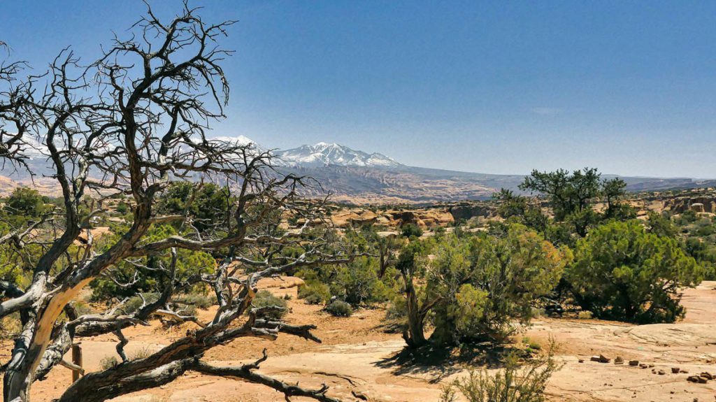
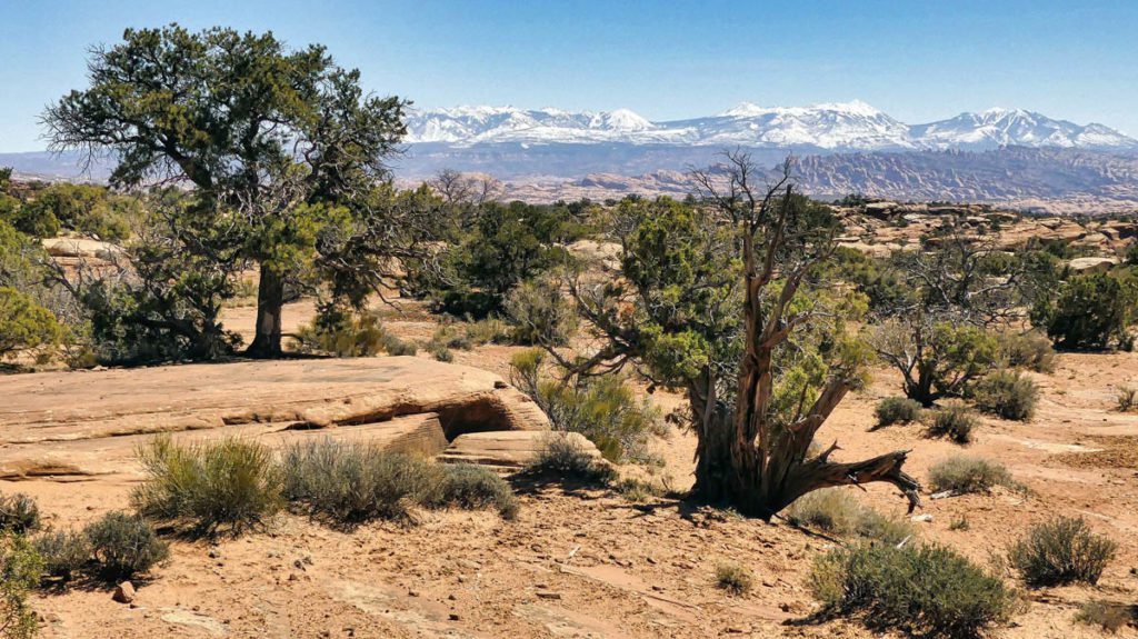
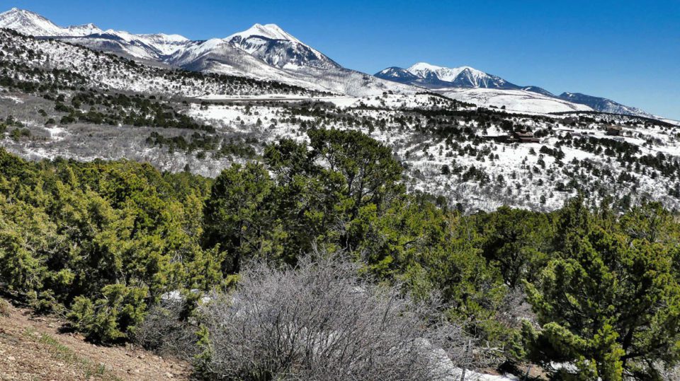
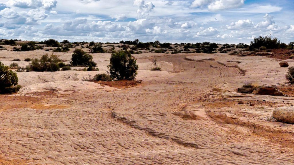
As I narrowed down the different areas I visited, I couldn’t help but be amazed at the diversity of experiences Moab has to offer. From the mesmerizing red rock formations to the tranquil flowing rivers, this destination truly has it all.

First on my list was the iconic Arches National Park, a haven of natural wonders boasting over 2,000 captivating sandstone arches. As the golden rays of the sun illuminated the red-hued landscape, I found myself in awe of delicate arches, such as the world-famous Delicate Arch and Landscape Arch. The ethereal beauty of these natural sculptures left me breathless, reminding me of the delicate balance between time and nature’s artistry.

Discover Moab Utah
Geyser Pass
Discover Moab Utah
Willow Springs – back way into Arches NP. You enter by Balanced Rock.
Discover Moab Utah
‘Pucker Pass’ is a high mountain pass at an elevation of 5,849 ft. above the sea level. It was named ‘Pucker Pass’ by some imaginative Jeepers back in the days when a drive down the canyon was a lot more hair-raising than it is now.
Discover Moab Utah
Long Canyon Road is located in the Sky district of the Canyonlands National Park, just north of Moab. The road is 7.5 miles long running west-east. The majority of this trail is pretty smooth, however, there are a few bumpy sections; especially when you head through ‘Pucker Pass’ where it gets both narrow and steep.

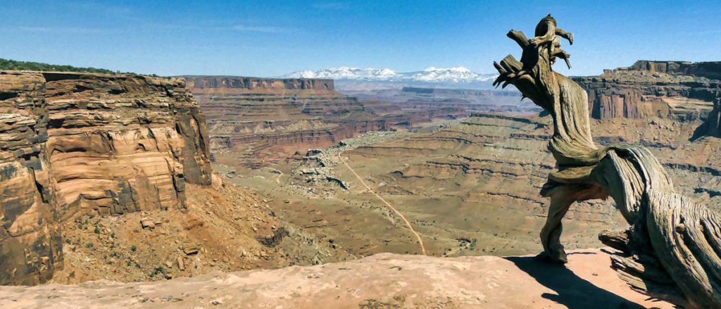
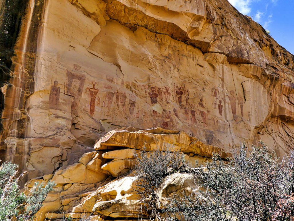
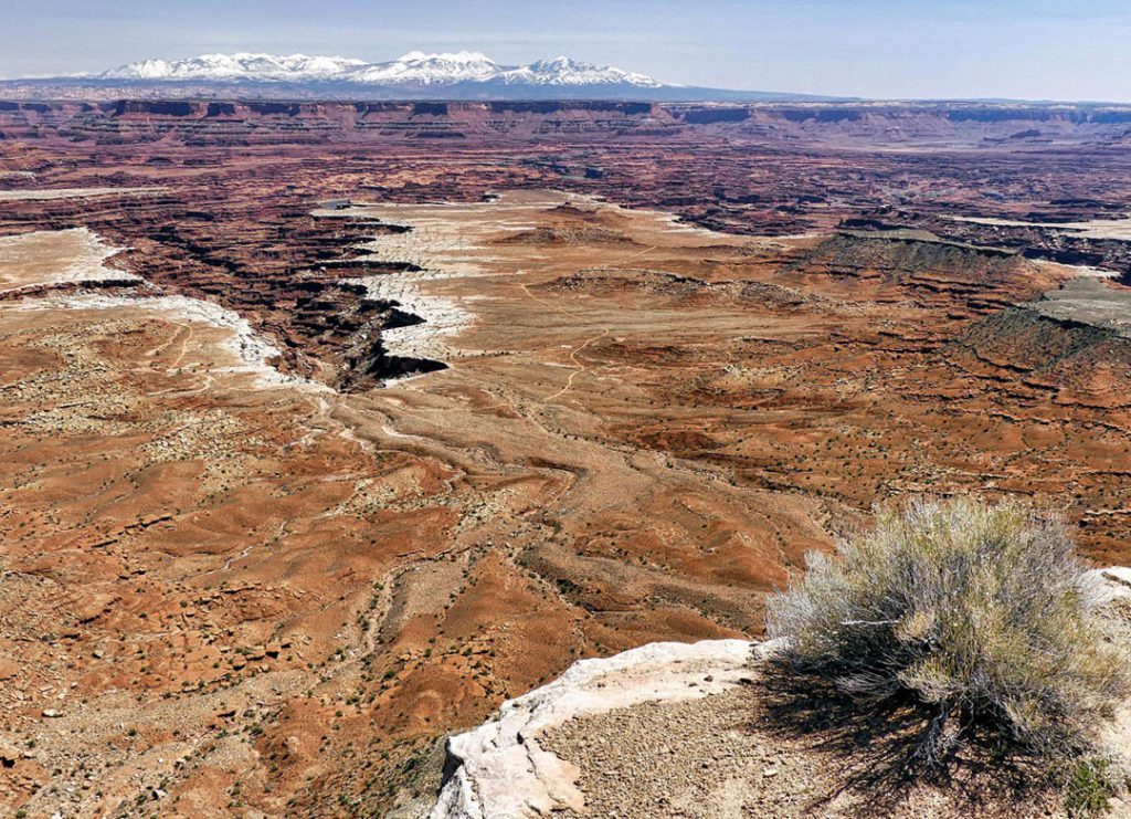
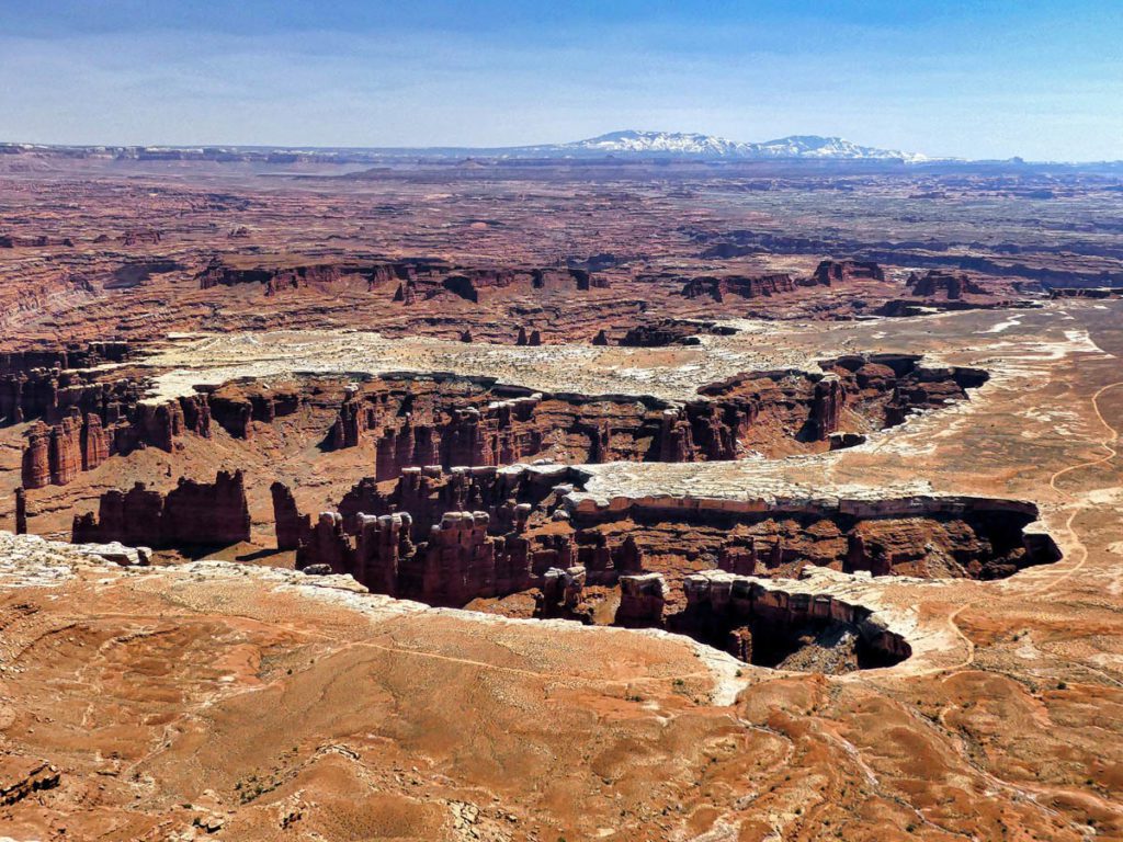
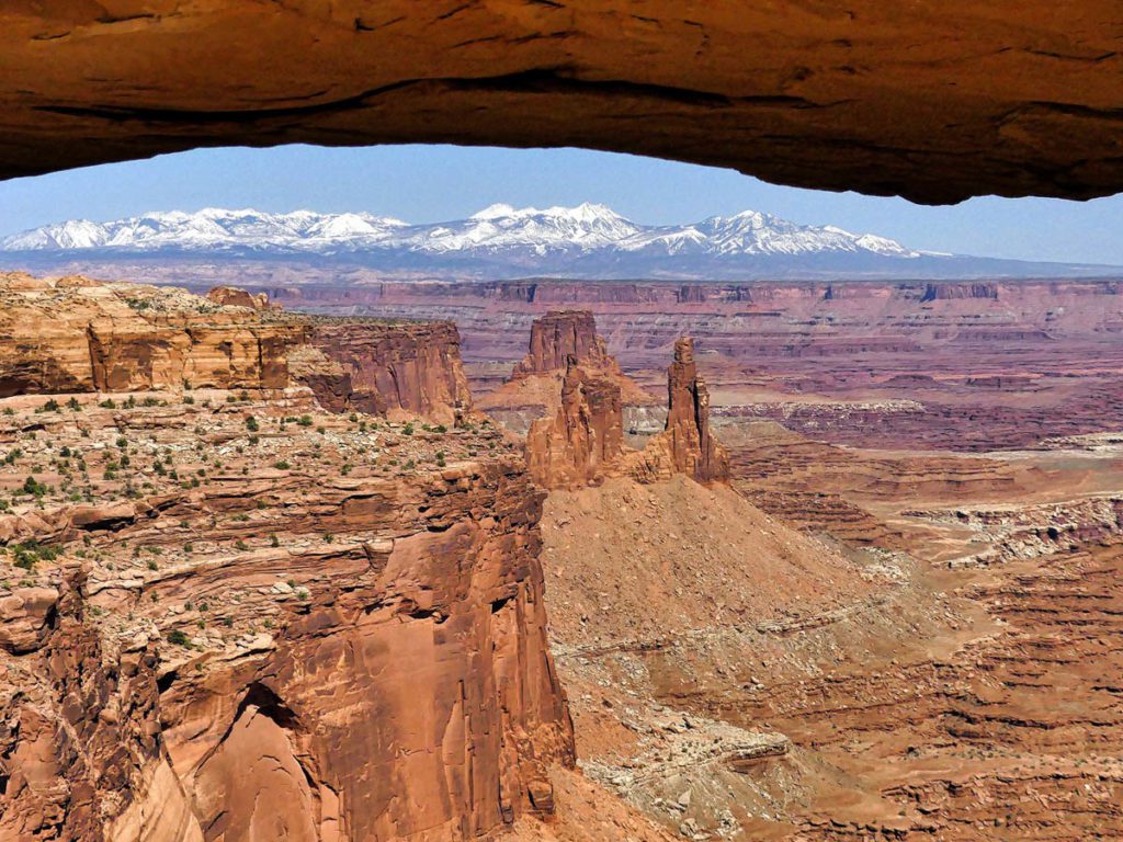
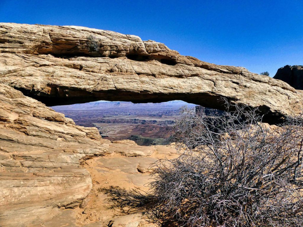
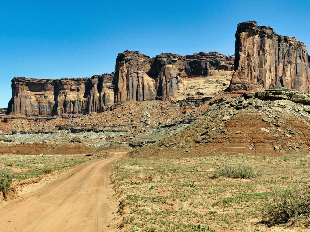
Next, I ventured into the enchanting Canyonlands National Park, a geological masterpiece carved by the mighty Colorado and Green Rivers. As I stood at the Island in the Sky viewpoint, the vastness of the canyonlands stretched before me, revealing a tapestry of towering cliffs, deep canyons, and intricate mesas. The mesmerizing panoramic views beckoned me to explore further, and I eagerly descended into the depths of the park, discovering hidden alcoves, ancient rock art, and a profound sense of tranquility.

Discover Moab Utah

Discover Moab Utah
Sego Canyon
Discover Moab Utah
American Fuel Company Store, Sego Canyon, UT
Discover Moab Utah
Along U-313. U-313 is a 22.5 mile (36.2 km) long State highway that winds its way through Grand and San Juan Counties. The highway is the access road for Canyonlands National Park and Dead Horse Point State Park.

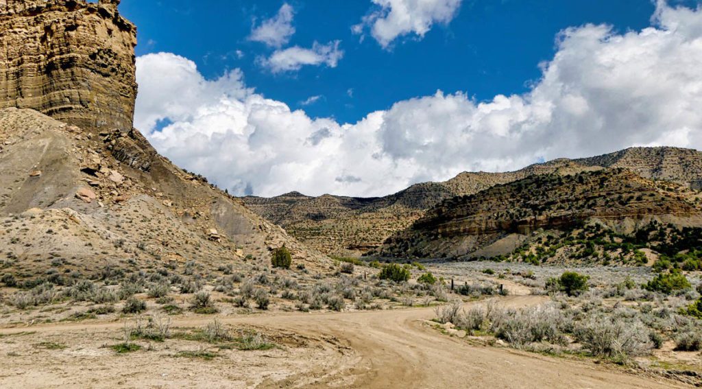
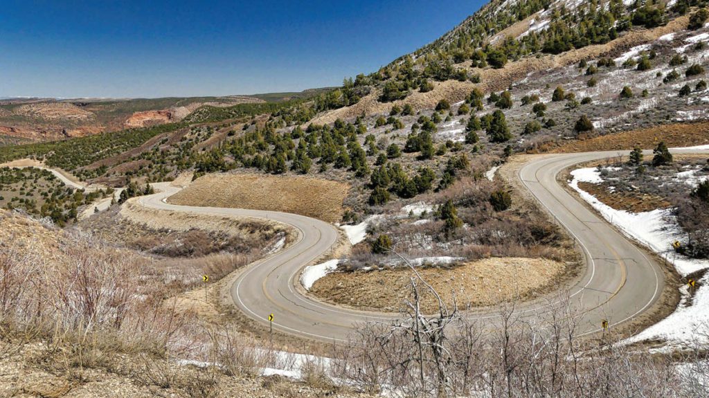
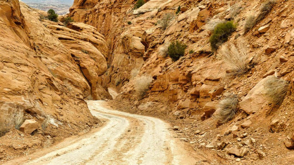
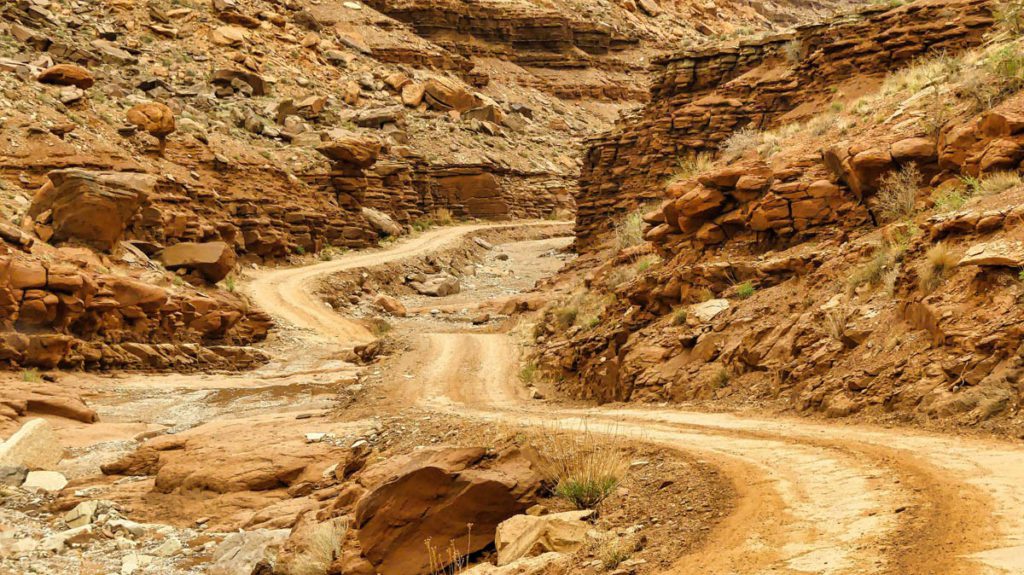
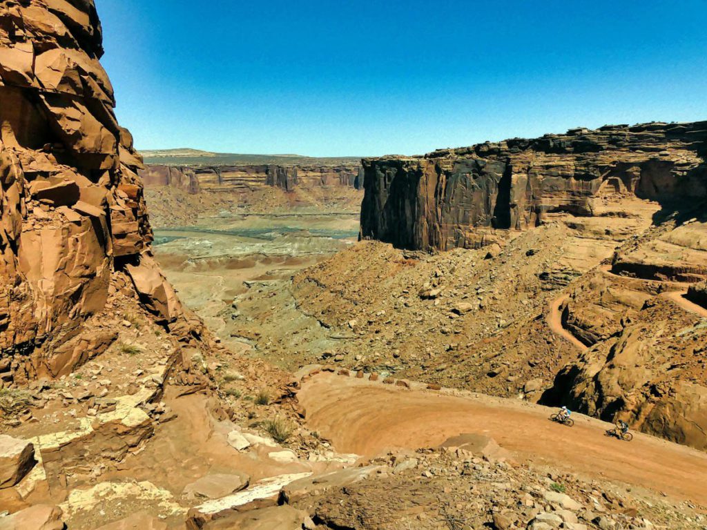
Leaving no stone unturned, I embarked on an off-road adventure through the rugged terrains of the infamous White Rim Road. The journey was both thrilling and humbling as I navigated the challenging backroads, witnessing the raw power of nature’s erosive forces. Towering cliffs and deep canyons surrounded me, while the silence of the desert punctuated by the occasional rustle of wildlife created a serene ambiance that touched my soul.

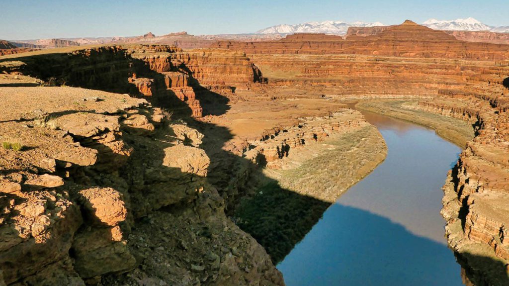
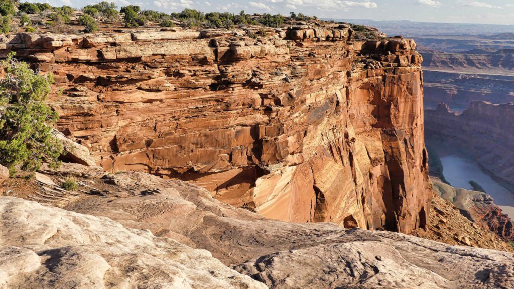
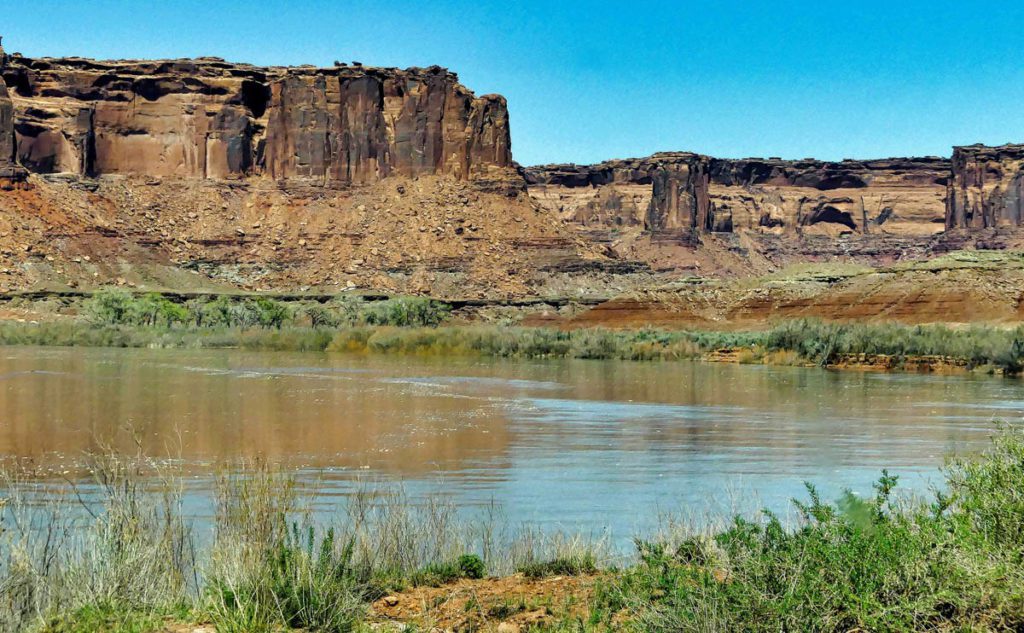
But Moab’s allure doesn’t end there. Venturing further, I discovered the picturesque landscapes of Dead Horse Point State Park, where the mighty Colorado River winds through a labyrinth of red rock formations. As I stood atop the iconic viewpoint, gazing at the river meandering through the canyon, I couldn’t help but marvel at the geological masterpiece below—a testament to the forces that have shaped this timeless landscape.

Discover Moab Utah
Dead Horse Point. Millions of years of geologic activity created the spectacular views from Dead Horse Point State Park. Deposition of sediments by ancient oceans, freshwater lakes, streams, and wind-blown sand dunes created the rock layers of canyon country. Igneous activity formed the high mountains that rise like cool blue islands out of the hot, dry desert.
Discover Moab Utah
Taken from Buck Canyon Overlook
Discover Moab Utah
Taken from Grand View Overlook. What you see is the White Rim Trail
Discover Moab Utah
Washer Woman is a 500-foot (150-meter) tall sandstone arch and tower located in the Island in the Sky District of Canyonlands National Park. Washer Woman is so named because the feature gives the appearance of a washerwoman bent over a washtub. A short hike to Mesa Arch provides the easiest view of Washer Woman. Access to this formation is via the four-wheel drive White Rim Road, which is the other option to see it.

Utah is undeniably a land of wonders, but Moab holds a special place in my heart. Its rugged beauty, rich history, and the memories of my very first visit in 1999 make it my favorite destination in the state. Moab is a haven for adventurers, nature enthusiasts, and those seeking solace in the embrace of awe-inspiring landscapes.

Whether you’re a thrill-seeker craving adrenaline-pumping activities like rock climbing, mountain biking, or whitewater rafting, or you simply yearn to connect with nature and immerse yourself in the stillness of the desert, Moab has something remarkable to offer.

Discover Moab Utah
Mesa Arch – Island in the Sky Trail. A short hike leads to a cliff-edge arch. Mesa Arch is a classic sunrise spot. It has stunning views toward the La Sal Mountains any time of day. Looking through the arch you can see Washer Woman.
Discover Moab Utah
Mineral Bottom Road. The trail is located in the southeastern part of Utah just outside Canyonlands National Park, so no permits are required. The trail, also known as Horse Thief Trail, is a 31.8-mile out-and-back trail near Moab, Utah. It is about 13 miles to the switchbacks that lead you down to the White Rim Trail and the Green River. It has some steep sections, hitting a 21% of maximum gradient through some of the ramps. Otherwise, it is a fairly easy trail when dry.

Discover Moab Utah

Discover Moab Utah
The White Rim Road was constructed in the 1950’s by the Atomic Energy Commission to gain access to the uranium deposits in this area. However, the mines produced very little uranium and were soon abandoned. The road gets its name because it traverses the top of White Rim Sandstone. Geologically, this is the layer of rock that sits right below the mesa of Island in the Sky. Along the drive, you will gaze up at the Island in the Sky mesa and peer down into the canyons carved out by the Green River and Colorado River. Mineral Bottom Road provides access to the western half of the White Rim. Just a small part of White Rim Trail is outside of Canyonlands NP. You do not need a permit to travel this short distance. However, once inside the park, a permit is required. What you see in my photo is the Green River.
Discover Moab Utah
Sand Flats Rd. The Sand Flats Recreation Area (SFRA) near Moab, Utah is a nationally significant public lands treasure at the heart of the Colorado Plateau. A high plain of slick rock domes, bowls and fins, it rises in the east to meet the colorful mesas and nearly 13,000 foot peaks of the La Sal Mountains.

So, join me in this virtual exploration of Moab, Utah, and allow yourself to be captivated by its timeless charm. Let the red rocks whisper their ancient tales, the canyons echo with the wisdom of the ages, and the vastness of the landscape inspire your soul. Moab awaits, ready to unveil its hidden treasures and create memories that will last a lifetime.

#DiscoverMoab #UtahAdventures #ExploreTheWest

Related posts

Locations to go to in Thailand

admin

Australia road trip 2022 : A 9-day West Coast Australia, Exmouth to Perth

admin

Best things to do in Bali Indonesia in 2023

admin

Leave a Comment